Magic Kingdom Map Found in a Main Street Wall
 Mitch
Mitch While doing occasional work on Main Street, U.S.A. (Magic Kingdom) we had the thrill of walking between the walls. That is, the space between those great-looking Main Street facades and the actual buildings behind them. On the ground level there are few areas of dead space between walls, mostly due to large doorways and windows. On the upper level, however, there are long narrow walkways behind the facades which accommodate decorations (lamps, chairs, etc.) intended to be seen from the street below. These are designed to look like turn-of-the-century shop keepers' residences. You know, the shop owners would live in apartments above their shops back in olden times. Anyway, the offices behind are your regular, windowless run-of-the-mill boring offices.
So one day I was behind a wall and THERE IT WAS... An old folded-up yellowed piece of paper shoved between wooden framing and drywall. It looked like it could have been a big ol' souvenir poster map and it was. Poster-sized, old, and in pretty good shape. I had always been on the lookout for these things since boyhood- long before ebay.
So how long had it been there? Why was it there? Who put it there? Did some custodial guy buy it at a gift shop, leave it behind the wall until after his shift, then never remember to come back for it? By the looks of things it was stuck behind the framing for some time. The exposed surface of the paper was significantly more yellow than any other part. I imagine it could have been there for 30 years. The best part: No one on the project wanted it and it was to be trashed if I didn't take it home. Tough decision.
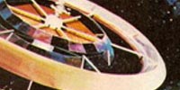
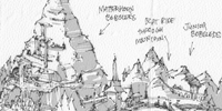
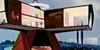
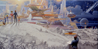
Without a year printed on the map it was up to the process of deduction to know when it was made. Some things you see: Pirates of the Caribbean- so it was made after '73. Carousel of Progress and Space Mountain are there- so it had to be '74 or later. You don't see any sign of Big Thunder- so it's definitely earlier than '80. It can't be later than June '75 because you still see Flight to the moon and there is no mention of it's successor Mission to Mars. One final clue: Look at Space Mountain. It looks more like John Hench concept art or the rendering below than the Space Mountain built in '74. Check out all the extra spires. So the map artwork had to be from a time between the announcement of this new ride and the completion of the ride building.
I'm sure Disney blog geeks everywhere know exactly when this map was made but without knowing exactly I had to guess mid 1974. Any earlier, Magic Carpet 'Round The World would be America the Beautiful. Any later, Space Mountain would not look like that.
Are there variations of this same map? Not sure but I imagine there are. By the late 70s the souvenir map had become much more cartoony with little kids in the Grand Prix cars and many more characters dancing around the poster and such.
So here the map sits- in my home office among other old souvenir poster maps from Disneyland, Epcot, EuroDisney, and even California Adventure. Sadly the Disneyland poster map that once hung on my childhood bedroom wall is long gone. But much like my grade school years, I sit and stare at these things and study them like a textbook. "NERD", you say??? Tell me I'm not the only one. Admit it. You do the same.
Things you may or may not miss from this era...
Tropical Serenade without plastic flying carpets blocking the view.

Mike Fink Keel Boats
Plaza Swan Boats
Main Street Cinema when it was a cinema.
The Mickey Mouse Review
Fantasy Faire Stage
Related posts:
1962 Disneyland Souvenir Map - High Res
Fantasyland Expansion Model
THEN AND NOW: MK Tomorrowland [Part 1]
THEN AND NOW: Liberty Square [Part 1]
THEN AND NOW: MK Fantasyland [Part 1]
Swiss Family Treehouse Model
 Behind-the-Scenes,
  Magic Kingdom,
  Maps,
Maps,  Mystery

